National-level data and methods
The national-level data on LandMark are displayed according to country boundaries, and are based on research and literature reviews. The geographic boundaries for presenting the national-level data on LandMark are sourced from the GADM Database of Global Administrative Areas.
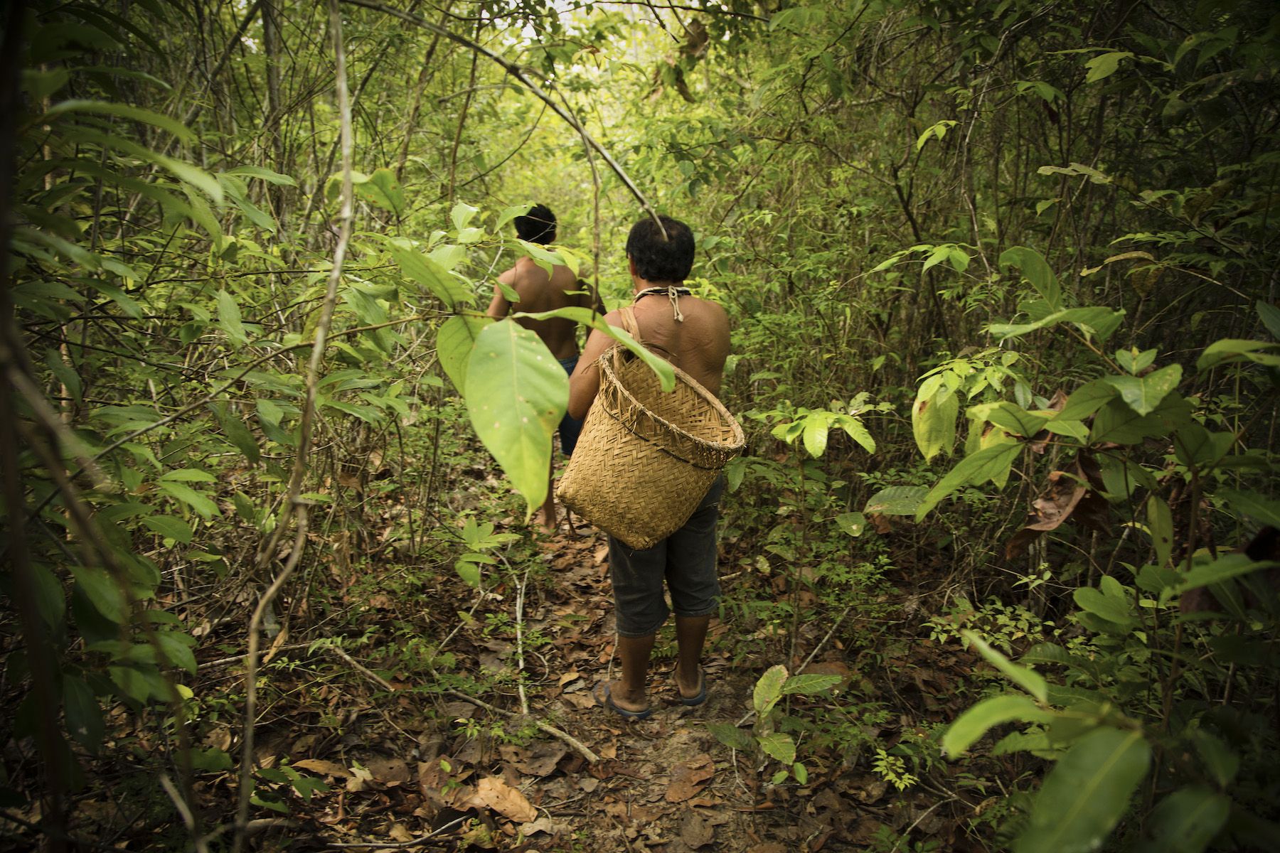
This image was taken with the consent and cooperation of the Yudja Indigenous people and the authorization of the Brazilian National Indian Foundation - FUNAI
Percent of country held by Indigenous Peoples and Communities
These maps show the estimated area of land held or used by Indigenous Peoples and local communities per country as a percentage of the country’s total land area.
Typology
The data are divided into three categories for the purposes of categorizing, symbolizing, and displaying national level data on LandMark:
Attributes
Additional descriptive information is available for each country by clicking on the geographic feature in the interactive map. The information displayed in the attribute table is as follows:
Attribute table for percent of country held by Indigenous Peoples and Communities
ISO 3-letter country code for identifying the country
Country name - UN Standard
The estimated TOTAL proportion of the country that is held or used by Indigenous Peoples and local communities. This percentage is calculated as the sum of the area acknowledged and not acknowledged by government (if known), divided by the total area of the country.
The estimated TOTAL area (in hectares) of the country that is held or used by Indigenous Peoples and local communities. It is the sum of the area that is acknowledged and not acknowledged by government (if known).
The organization or individual that provided the TOTAL estimate of area/percent of the country held or used by Indigenous Peoples and local communities and the year of estimation.
The estimated proportion of the country that is held or used by Indigenous Peoples and local communities and is acknowledged by government (i.e., formally recognized by the State). This percentage is calculated as the sum of the area acknowledged by government, divided by the total area of the country.
The estimated area (in hectares) of the country that is held or used by Indigenous Peoples and local communities and is acknowledged by government (i.e., formally recognized by the State).
The organization or individual that provided the estimate of area/percent of the country held or used by Indigenous Peoples and local communities and acknowledged by government and the year of estimation.
The estimated proportion of the country that is held or used by Indigenous Peoples and local communities and is NOT acknowledge by government (i.e., not formally recognized by the State). This percentage is calculated as the sum of the area not acknowledged by government, divided by the total area of the country.
The estimated area (in hectares) of the country that is held or used by Indigenous Peoples and local communities and is NOT acknowledge by government (i.e., not formally recognized by the State).
The organization or individual that provided the estimate of area/percent of the country held or used by Indigenous Peoples and local communities that is NOT acknowledged by government and the year of estimation.
Additional notes regarding the source or methods of the estimates.
Documentation
The methods or resources used for estimating the amount of land held or used vary for different countries or regions of the world. They may be based on:
- information collected from published reports and websites of credible organizations;
- the grey literature of experts and land rights organizations;
- or, when there is no information published, the estimates of experts in combination with a method that excludes all non-indigenous and community lands (including urban land, protected areas, etc.).
The following documents, organized by region, provide more details on the methods and resources used in estimating the percentages for each country:
Africa
Americas
Asia
Europe
Oceania
Data displayed on LandMark
You can view national estimates for percentage of land held by Indigenous Peoples and Communities on the “National estimates” tab of LandMark’s Global map, which can be toggled to show by the same outlined typology of:
- total percent of country held or used by Indigenous Peoples and local communities;
- percent of country held that is acknowledged by government;
- percent of country held that is not acknowledged by government.
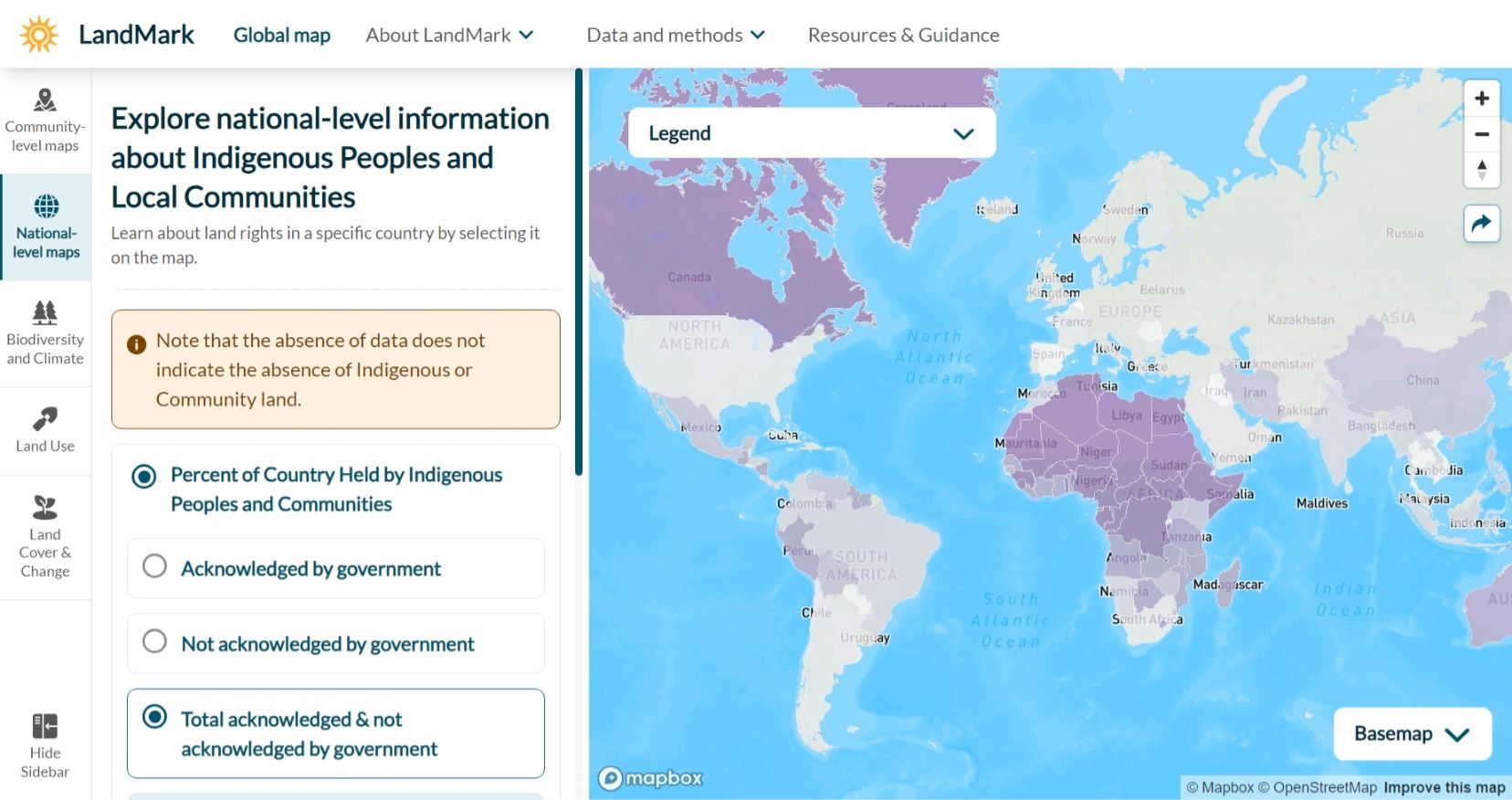
Screenshot taken from LandMark’s Global map.
The estimates displayed on the map are categorized into ranges of percentages. The precise value and more information about the source of the estimate can be viewed by clicking on a country on the map and then clicking “view selected country” in the pop up that opens.
LandMark recognizes that Indigenous Peoples and local communities often enjoy different rights and protections at national level. At present, available data does not allow for their disaggregation; however, where available, this information is provided on country detail pages. A further breakdown of the data into estimates of lands held or used by Indigenous Peoples only and communities only are under development.
For some countries and categories, “No data” is displayed in lieu of a percentage. No data represents one of two scenarios:
- There was not enough information found through research to make an estimate.
- The country or category has not yet been evaluated.
The “Notes” box for each country and category provides additional information on the specific circumstance. The notes will recognize if only partial information is available.
Indigenous population per country
These statistics show the estimated indigenous population per country, both as a percentage of the country total population, and as numeric indigenous population counts.
The methods or resources used for estimating the indigenous population vary for different countries or regions of the world. They are based on a vast literature review of official censuses and non-governmental organizations’ estimates.
Please note that there is no definitive definition of who are Indigenous Peoples, which relies mostly on self-identification. The criteria used here to identify the peoples who may claim their indegeneity vary across regions of the world, and the population counts may be based on incomplete and/or biased sources depending on their methods of acquisition.
Data displayed on LandMark
Estimates for individual countries can be seen by clicking on a country on the map and then clicking “view selected country” in the pop up that opens.
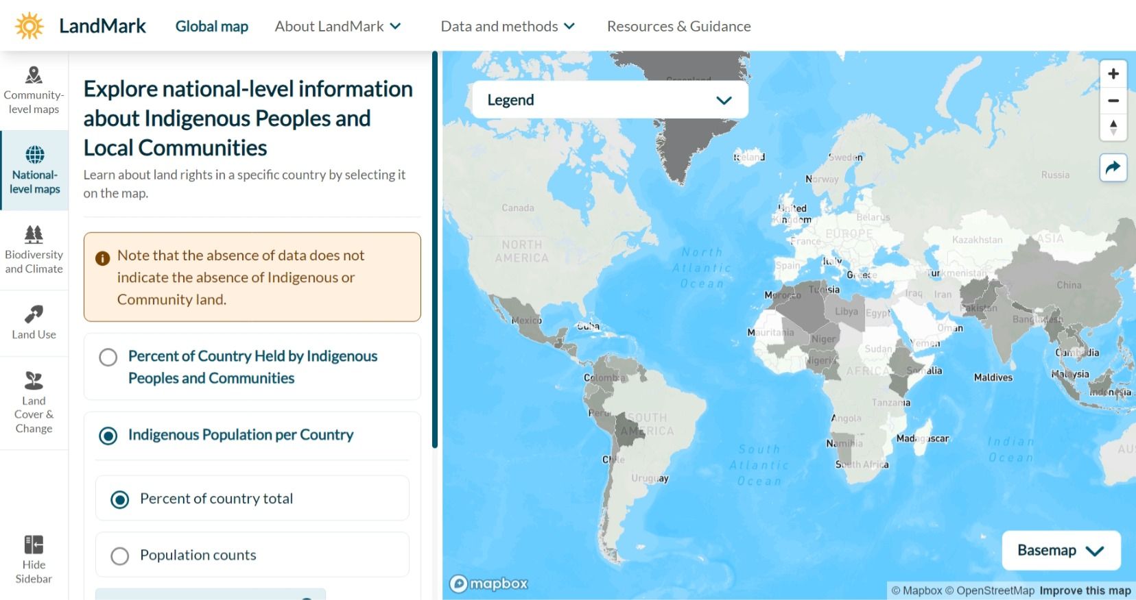
Screenshot taken from LandMark’s Global map.
For some countries and categories, “No data” is displayed in lieu of a percentage or population count. No data represents one of two scenarios:
- There was not enough information found through research to make a reliable estimate;
- The country or category has not yet been evaluated.
The “Notes” field in the attribute table for each country and category provides additional information on the specific circumstance. The notes will recognize if only partial information is available.
Indicators of Indigenous Peoples' and Local Communities' Tenure Security in National Laws
A dataset characterized by a series of ten indicator questions that point to the security of land tenure for Indigenous Peoples or local communities as established in national laws.
National laws were evaluated separately for Indigenous Peoples and Local Communities because some countries have laws that apply differently depending on identity. Data for each are accessed via subcategories for "Indigenous Peoples' Land and Resource Rights" or "Local Communities' Land and Resource Rights".
Clicking on a country provides access to scores for each of the ten indicator questions:
- Does the law recognize all rights that Indigenous Peoples or communities exercise over their lands as lawful forms of ownership?
- Does the law give indigenous or community land rights the same level of protection as the rights under other tenure systems?
- Does the law require the government to provide Indigenous Peoples or communities with a formal title and map to their land?
- Does the law recognize the Indigenous Peoples or community as a legal person for the purposes of land ownership?
- Does the law recognize the Indigenous Peoples or community as the legal authority over the land?
- Do the law and formal title recognize that indigenous or community land rights may be held in perpetuity?
- Does the law require the consent of Indigenous Peoples or communities before government or an outsider may acquire their land?
- Does the law explicitly recognize that indigenous or community land rights include the rights to all trees on the land?
- Does the law explicitly recognize that indigenous or community land rights include the rights to local water sources on the land?
- Does the law uphold indigenous or community land rights in the ownership and governance of national parks and other protected areas?
The indicator questions are scored according to the following rubric:
- Score 1 = Yes, the law addresses the issue fully.
- Score 2 = Partial, the law makes significant progress towards addressing the issue.
- Score 3 = Partial, the law makes only limited progress towards addressing the issue.
- Score 4 = No, the law does not address the issue.
Data for African countries were updated in 2025; other countries were last updated in 2015-2018.
Data and Methods
The following document (in pdf format) describes in more detail the method for conducting research and scoring the Indicators of Tenure Security in National Law.
Indicators of tenure security in national law
Guidelines for researching, scoring and documenting findings
National-level data sources
National-level data are generated from research, expert knowledge, and spatial data analysis. Data sources are listed by dataset and citation information.